Size of this preview: 474 × 600 pixels. Other resolution: 632 × 800 pixels.
Original file (632 × 800 pixels, file size: 87 KB, MIME type: image/png)
Summary
Summary
| Description |
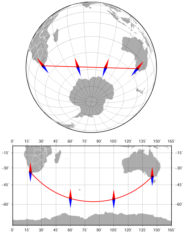
English: The bearing and azimuth between Cape Town and Melbourne along the geodesic (the shortest route) change from 141° to 42°. Azimuthal orthographic projection (the upper map) and Miller cylindrical projection (the lower map). |
|---|---|
| Source |
Own work Template:Created with GMT |
| Date |
2015-03-01 |
| Author | |
| Permission (Reusing this file) |
See below.
|
Licensing
| This work is licensed under the Creative Commons Attribution 4.0 License. |
File history
Click on a date/time to view the file as it appeared at that time.
| Date/Time | Thumbnail | Dimensions | User | Comment | |
|---|---|---|---|---|---|
| current | 19:06, 1 January 2024 | | 632 × 800 (87 KB) | Isidore (talk | contribs) | =={{int:filedesc}}== {{Information |description={{en|1=The bearing and azimuth between Cape Town and Melbourne along the geodesic (the shortest route) change from 141° to 42°. Azimuthal orthographic projection (the upper map) and Miller cylindrical projection (the lower map).<br /> The map was created using the [http://gmt.soest.hawaii.edu/projects/gmt Generic Mapping Tools], GMT, version 5.1.1.}} |date=2015-03-01 |source={{own}} {{Created with GMT}} |author=Darekk2 |permissi... |
You cannot overwrite this file.
File usage
The following page uses this file: