
Original file (1,280 × 568 pixels, file size: 296 KB, MIME type: image/png)
Summary
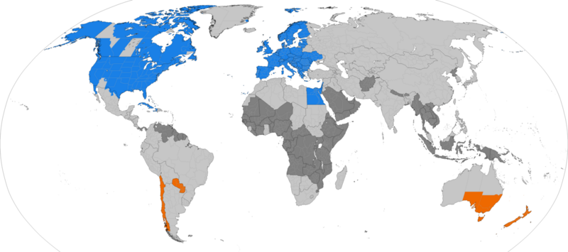
Larger map of the previous version. Distinguished from summertime in the northern hemisphere and southern hemisphere.
 Northern hemisphere summer
 Southern hemisphere summer
 Formerly used daylight savings
 Never used daylight savings
Date 30 May 2013 Source Own work Author TimeZonesBoy Other versions Supplementary map:
This file is licensed under the Creative Commons Attribution-Share Alike 3.0 Unported license. You are free: to share – to copy, distribute and transmit the work to remix – to adapt the work Under the following conditions: attribution – You must give appropriate credit, provide a link to the license, and indicate if changes were made. You may do so in any reasonable manner, but not in any way that suggests the licensor endorses you or your use. share alike – If you remix, transform, or build upon the material, you must distribute your contributions under the same or compatible license as the original.
File history
Click on a date/time to view the file as it appeared at that time.
| Date/Time | Thumbnail | Dimensions | User | Comment | |
|---|---|---|---|---|---|
| current | 17:43, 4 November 2023 | | 1,280 × 568 (296 KB) | Isidore (talk | contribs) | Larger map of the previous version. Distinguished from summertime in the northern hemisphere and southern hemisphere. Northern hemisphere summer Southern hemisphere summer Formerly used daylight savings Never used daylight savings Date 30 May 2013 Source Own work Author TimeZonesBoy Other versions Supplementary map: This file is licensed under the Creative Commons Attribution-Share Alike 3.0 Unported license. You are free: to share – to copy, distribute and transmit the work to remix... |
You cannot overwrite this file.
File usage
The following page uses this file: