
Size of this PNG preview of this SVG file: 800 × 526 pixels. Other resolution: 2,560 × 1,684 pixels.
Original file (SVG file, nominally 1,280 × 842 pixels, file size: 59 KB)
Summary
Summary
| Description |
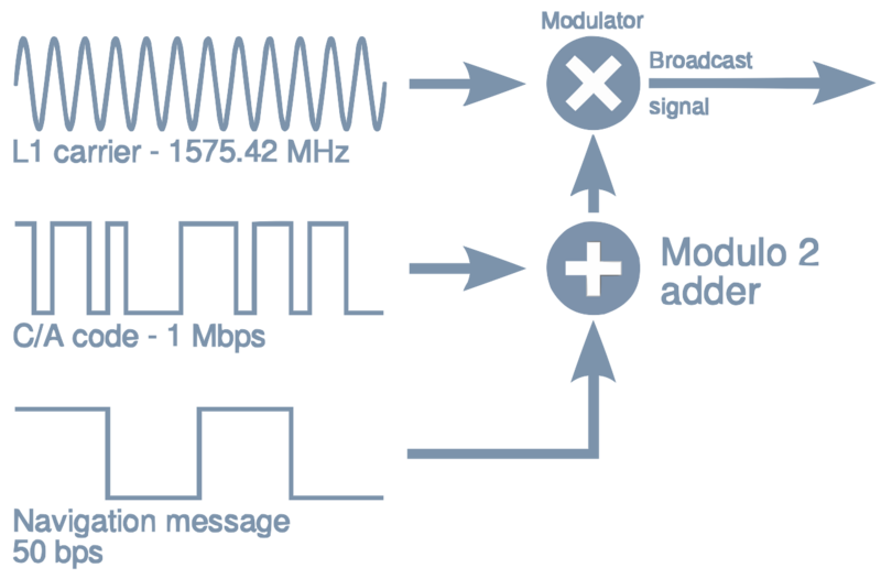
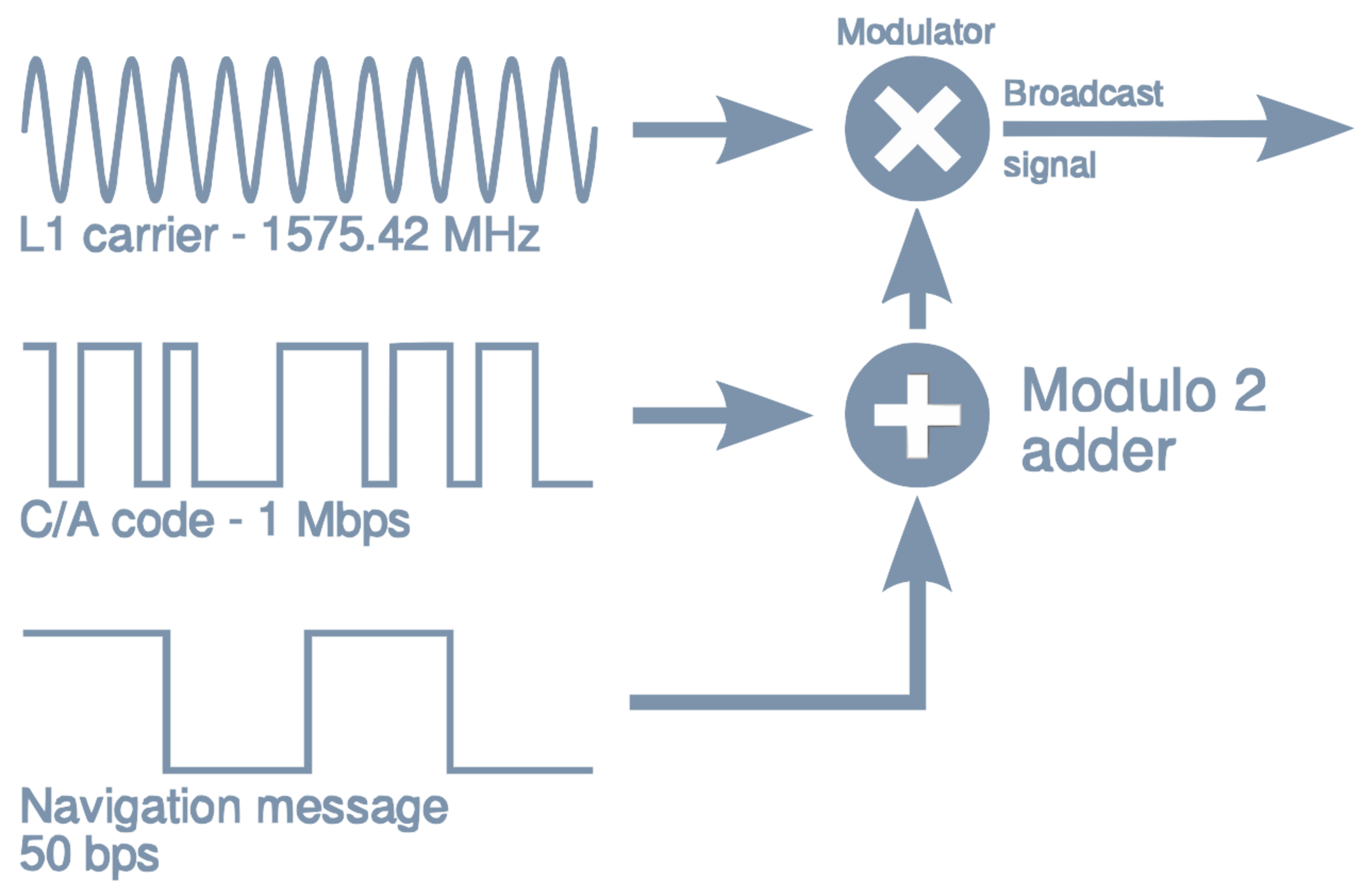
Self-made, based on en:Image:GPS-broadcast-signal.png. | ||||||
|---|---|---|---|---|---|---|---|
| Source | |||||||
| Date | |||||||
| Author |
P. F. Lammertsma, converted to vector by Denelson83 | ||||||
| Permission (Reusing this file) |
|


File history
Click on a date/time to view the file as it appeared at that time.
| Date/Time | Thumbnail | Dimensions | User | Comment | |
|---|---|---|---|---|---|
| current | 16:50, 20 January 2024 | | 1,280 × 842 (59 KB) | Isidore (talk | contribs) | == {{int:filedesc}} == {{Information |description = Self-made, based on en:Image:GPS-broadcast-signal.png. |date = {{Original upload date|2006-11-19}} |source = [http://paul.luminos.nl/download/document/satellite_navigation.pdf Satellite Navigation, P. F. Lammertsma, p. 9] |author = P. F. Lammertsma, converted to vector by Denelson83 |permission = {{Self|GFDL|Cc-by-sa-3.0-migrated}} |other_versions = }} |
You cannot overwrite this file.
File usage
The following page uses this file: