File:Garfield County Oklahoma incorporated and unincorporated areas Enid highlighted.svg
File on OODA WIKI

Size of this PNG preview of this SVG file: 675 × 599 pixels. Other resolution: 2,307 × 2,048 pixels.
Original file (SVG file, nominally 865 × 768 pixels, file size: 115 KB)
Summary
Summary
| Description |
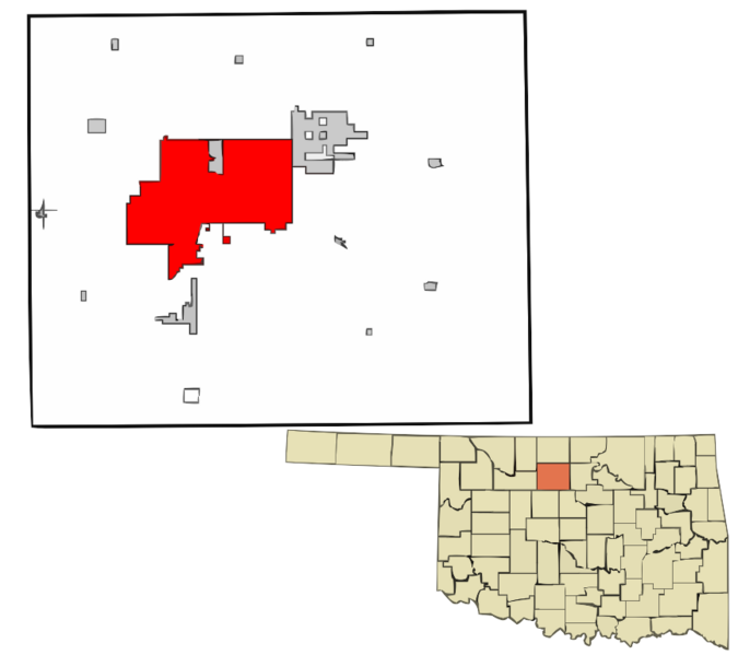
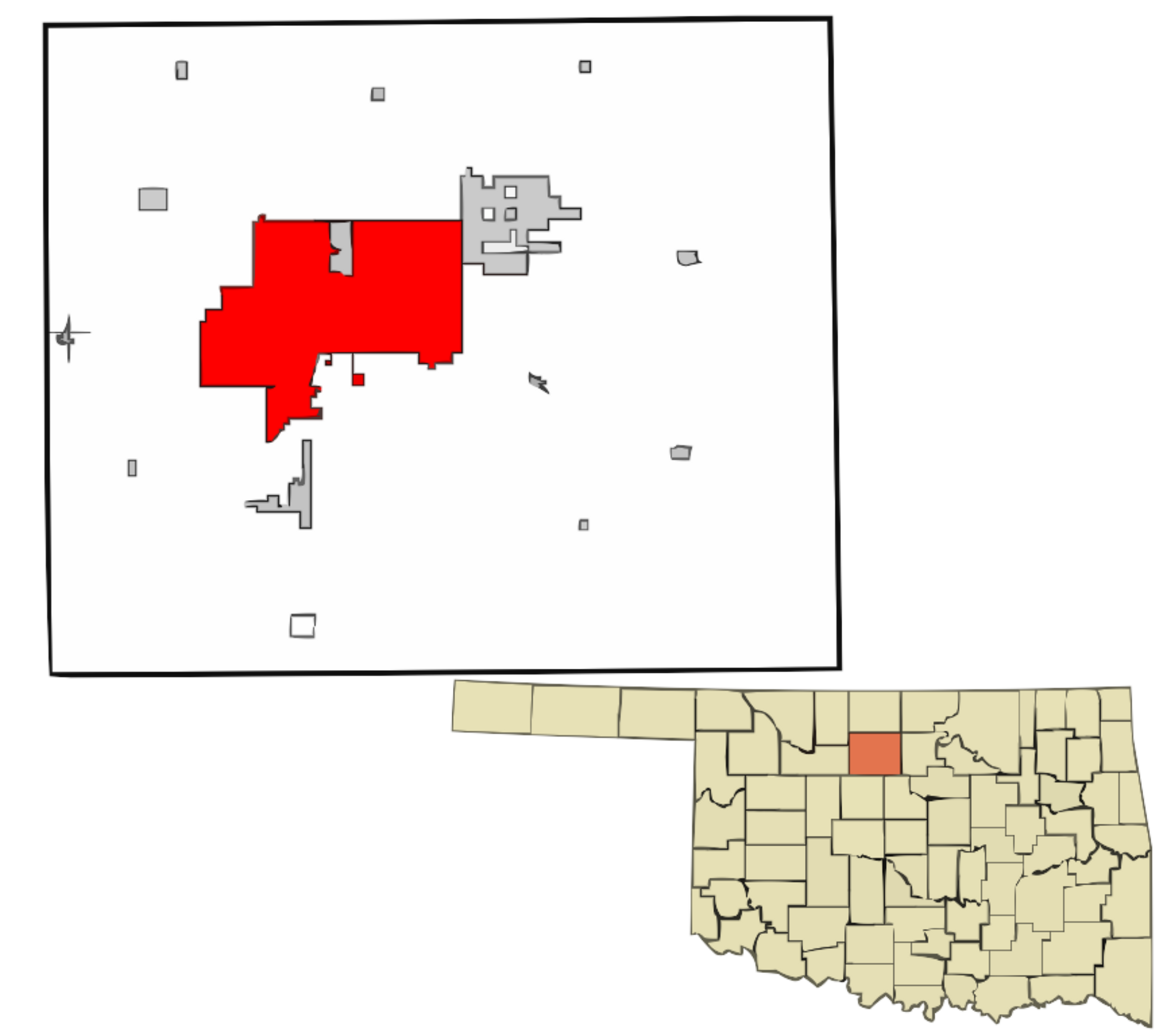
English: Map showing the location of this city within Garfield County, Oklahoma. Data source: 2010 U.S. census |
|---|---|
| Source |
Own work |
| Date |
2015-11-30 |
| Author | |
| Permission (Reusing this file) |
See below.
|
Licensing
I, the copyright holder of this work, hereby publish it under the following license:
|
File history
Click on a date/time to view the file as it appeared at that time.
| Date/Time | Thumbnail | Dimensions | User | Comment | |
|---|---|---|---|---|---|
| current | 15:53, 15 March 2024 | | 865 × 768 (115 KB) | Isidore (talk | contribs) | =={{int:filedesc}}== {{Information |description={{en|1=Map showing the location of this city within Garfield County, Oklahoma. Data source: [http://www2.census.gov/geo/maps/dc10map/tract/st40_ok/c40047_garfield/DC10CT_C40047_001.pdf 2010 U.S. census]}} |date=2015-11-30 |source={{own}} |author=Rcsprinter123 |permission= |other versions= }} =={{int:license-header}}== {{self|cc-by-3.0}} Category:Maps of Enid, Oklahoma |
You cannot overwrite this file.
File usage
The following page uses this file: