
Size of this preview: 800 × 531 pixels. Other resolution: 1,280 × 850 pixels.
Original file (1,280 × 850 pixels, file size: 468 KB, MIME type: image/jpeg)
Summary
Summary
| Description |
Lua error in Module:Unicode_data at line 15: attempt to call field 'length' (a nil value). |
|---|---|
| Source |
http://eol.jsc.nasa.gov/scripts/sseop/photo.pl?mission=ISS021&roll=E&frame=15710 |
| Date |
2009-10-27 17:57:32 |
| Author |
|
| Permission (Reusing this file) |
See below. |
| Other versions |
|
Lua error: callParserFunction: function "#coordinates" was not found. Template:Object location dec Template:NASA-image
Licensing
| This file is in the public domain, because (no reason given!)
Please verify that the reason given above is valid! Note: if there is a specific licence tag for the reason supplied here, please use it. |
File history
Click on a date/time to view the file as it appeared at that time.
| Date/Time | Thumbnail | Dimensions | User | Comment | |
|---|---|---|---|---|---|
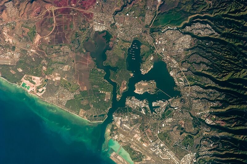
| current | 21:42, 5 December 2023 | | 1,280 × 850 (468 KB) | Isidore (talk | contribs) | =={{int:filedesc}}== {{Information |description={{en|1=This detailed astronaut photograph illustrates the southern coastline of the Hawaiian island Oahu, including Pearl Harbor. On December 7, 1941—68 years ago—a surprise attack by the Japanese Navy on Pearl Harbor and other targets on the island of Oahu precipitated the entry of the United States into World War II. Today, Pearl Harbor is still in use as a major United States Navy installation, and along with Honolulu, it is one of the most h... |
You cannot overwrite this file.
File usage
The following page uses this file: