Size of this preview: 477 × 599 pixels. Other resolution: 1,034 × 1,299 pixels.
Original file (1,034 × 1,299 pixels, file size: 458 KB, MIME type: image/jpeg)
Summary
Summary
| Description |
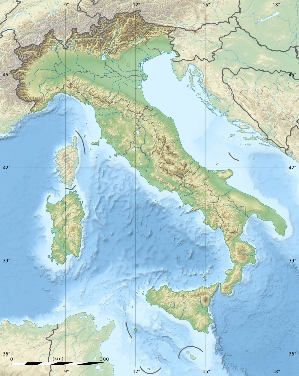
English: Blank physical map of Italy including the 08-2009 modification of the boundary between Emilia-Romagna and Marche regions, for geo-location purpose.
Template:Fr
Equirectangular projection, WGS84 datum
Geographic limits of the map:
|
|---|---|
| Source |
|
| Date |
2009-05 |
| Author |
Eric Gaba (Sting - fr:Sting) and NordNordWest |
| Permission (Reusing this file) |
|
| Other versions | Template:DerivativeVersions
|

- REDIRECT Target page name
Template:Kartenwerkstatt Template:Atelier graphique carte
Licensing
 | Permission is granted to copy, distribute and/or modify this document under the terms of the GNU Free Documentation License, Version 1.2 or any later version published by the Free Software Foundation; with no Invariant Sections, no Front-Cover Texts, and no Back-Cover Texts. |
| If this file is eligible for relicensing, it may also be used under the Creative Commons Attribution-ShareAlike 3.0 license. The relicensing status of this image has not yet been reviewed. You can help. |  |
File history
Click on a date/time to view the file as it appeared at that time.
| Date/Time | Thumbnail | Dimensions | User | Comment | |
|---|---|---|---|---|---|
| current | 21:01, 15 November 2023 | | 1,034 × 1,299 (458 KB) | Isidore (talk | contribs) | == {{int:filedesc}} == {{Information |Description={{en|Blank physical map of Italy including the 08-2009 modification of the boundary between Emilia-Romagna and Marche regions, for geo-location purpose.}} {{fr|Carte physique vierge de l'Italie intégrant la modification d'août 2009 de la frontière entre les régions Emilia-Romagna et Marche, destinée à la géolocalisation.}} Equirectangular projection, WGS84 datum<br/> *Standard meridian: 012° 36' E<br/> *Central par... |
You cannot overwrite this file.
File usage
The following 6 pages use this file: