Original file (787 × 799 pixels, file size: 352 KB, MIME type: image/png)
Summary
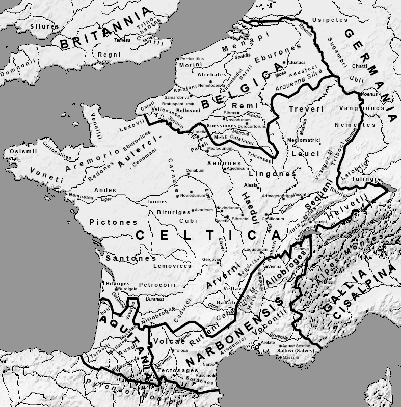
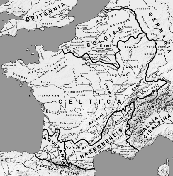
Afrikaans: Romeinse provinsies en stamgroepe van die Galliese gebied in die laat 1ste eeu v.C. Ελληνικά: Χάρτης της Γαλατίας και των κελτικών φυλών τον 1ο αιώνα π.Χ. Français : Provinces romaines et les peuples proto-basques, celtes et germanique à la fin du Ier siècle av. J-C. English: Roman provinces and the proto-Basque, Celtic and Germanic peoples at the end of the 1st century BC. J-C. Date 15 January 2005 Source Own work Author User:Feitscherg Other versions Derivative works of this file:
Map de Bello Gallico Liber2.png Map de Bello Gallico Liber6.png Map-de-Bello-Gallico-Liber3.png Map-de-Bello-Gallico-Liber4.png Map-de-Bello-Gallico-Liber5.png Namnetes.jpg Map Gallia Tribes Towns-es.svg Map Gallia Tribes Towns-la.svg
Licensing
 | Permission is granted to copy, distribute and/or modify this document under the terms of the GNU Free Documentation License, Version 1.2 or any later version published by the Free Software Foundation; with no Invariant Sections, no Front-Cover Texts, and no Back-Cover Texts. |
| If this file is eligible for relicensing, it may also be used under the Creative Commons Attribution-ShareAlike 3.0 license. The relicensing status of this image has not yet been reviewed. You can help. |  |
File history
Click on a date/time to view the file as it appeared at that time.
| Date/Time | Thumbnail | Dimensions | User | Comment | |
|---|---|---|---|---|---|
| current | 13:29, 24 October 2023 | | 787 × 799 (352 KB) | Isidore (talk | contribs) | Afrikaans: Romeinse provinsies en stamgroepe van die Galliese gebied in die laat 1ste eeu v.C. Ελληνικά: Χάρτης της Γαλατίας και των κελτικών φυλών τον 1ο αιώνα π.Χ. Français : Provinces romaines et les peuples proto-basques, celtes et germanique à la fin du Ier siècle av. J-C. English: Roman provinces and the proto-Basque, Celtic and Germanic peoples at the end of the 1st century BC. J-C. Date 15 January 2005 Source Own work Author User:Feitscherg Other versions Derivative works of this fil... |
You cannot overwrite this file.
File usage
The following page uses this file: