
Size of this PNG preview of this SVG file: 523 × 599 pixels. Other resolution: 1,787 × 2,048 pixels.
Original file (SVG file, nominally 1,787 × 2,048 pixels, file size: 406 KB)
Summary
Summary
| Description |
Lua error in Module:Unicode_data at line 15: attempt to call field 'length' (a nil value). |
|---|---|
| Source |
nationalatlas.gov, specifically countyp020.tar.gz on the Raw Data Download page. The maps also use state outline data from statesp020.tar.gz. |
| Date |
2006-02-12 |
| Author |
David Benbennick made this map. |
| Permission (Reusing this file) |
See below. |
| Other versions | For more information, see Commons:United States county locator maps. Template:Igen |
| I, the copyright holder of this work, hereby release it into the public domain. This applies worldwide. If this is not legally possible: |
File history
Click on a date/time to view the file as it appeared at that time.
| Date/Time | Thumbnail | Dimensions | User | Comment | |
|---|---|---|---|---|---|
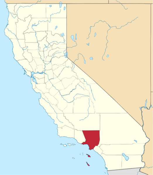
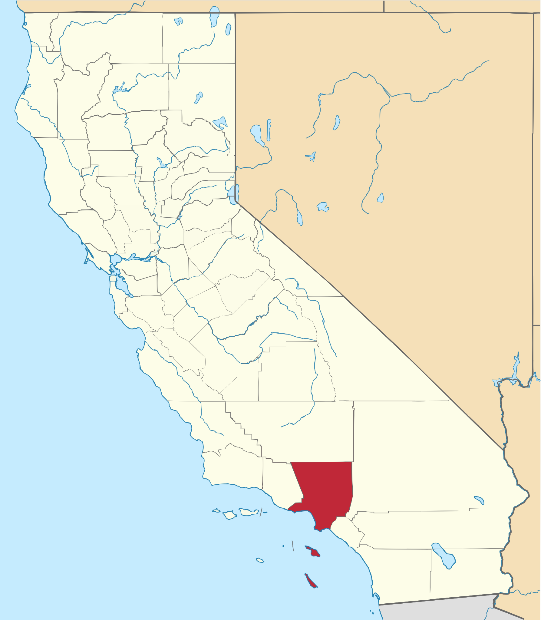
| current | 16:53, 9 March 2024 | | 1,787 × 2,048 (406 KB) | Isidore (talk | contribs) | == {{int:filedesc}} == {{Information |Description={{en|A locator map showing '''Los Angeles County''' — in '''Southern California'''.}} |Date=2006-02-12 |source=[http://www.nationalatlas.gov nationalatlas.gov], specifically [http://edcftp.cr.usgs.gov/pub/data/nationalatlas/countyp020.tar.gz countyp020.tar.gz] on the [http://www.nationalatlas.gov/atlasftp.html Raw Data Download] page. The maps also use state outline data f... |
| 16:46, 9 March 2024 |  | 1,022 × 1,171 (488 KB) | Isidore (talk | contribs) | == {{int:filedesc}} == {{Information |Description={{en|A locator map showing '''Los Angeles County''' — in '''Southern California'''.}} |Date=2006-02-12 |source=[http://www.nationalatlas.gov nationalatlas.gov], specifically [http://edcftp.cr.usgs.gov/pub/data/nationalatlas/countyp020.tar.gz countyp020.tar.gz] on the [http://www.nationalatlas.gov/atlasftp.html Raw Data Download] page. The maps also use state outline data f... |
You cannot overwrite this file.
File usage
The following 2 pages use this file: