Size of this preview: 800 × 449 pixels. Other resolution: 1,280 × 719 pixels.
Original file (1,280 × 719 pixels, file size: 110 KB, MIME type: image/png)
Summary
Summary
| Description |
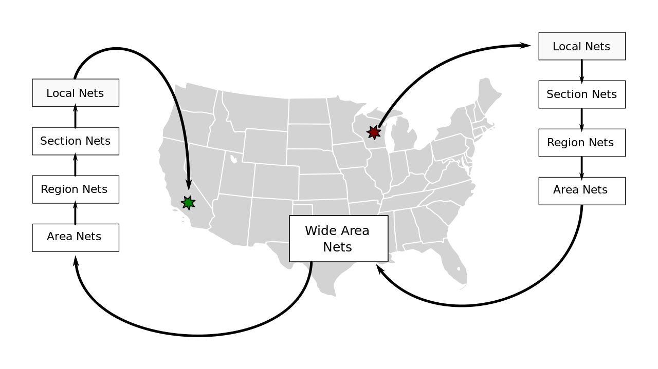
English: Visual representation of traffic passing of ARRL radiograms between various nets, from Wisconsin to California.Template:De |
|---|---|
| Source |
Own work |
| Date |
2013-07-10 19:11:11 |
| Author | |
| Permission (Reusing this file) |
See below.
|
Produced using part of image from http://www.mediawiki.org/wiki/File:BlankMap-USA-states-Canada-provinces.svg by Lokal_Profil.
Licensing
I, the copyright holder of this work, hereby publish it under the following license:
|
File history
Click on a date/time to view the file as it appeared at that time.
| Date/Time | Thumbnail | Dimensions | User | Comment | |
|---|---|---|---|---|---|
| current | 13:28, 11 March 2024 | | 1,280 × 719 (110 KB) | Isidore (talk | contribs) | =={{int:filedesc}}== {{Information |description={{en|1=Visual representation of traffic passing of ARRL radiograms between various nets, from Wisconsin to California.}}{{de|1=Visuelles Darstellung der ARRL Botschaftverkehrsystem, von Wisconsin bis California.}} |date=2013-07-10 19:11:11 |source={{own}} |author=Redxine |permission= |other_versions= |other_fields= }} Produced using part of image from http://www.mediawiki.org/wiki/File:BlankMap-USA-states-Canada-provinces.svg by... |
You cannot overwrite this file.
File usage
The following page uses this file: