Size of this preview: 450 × 600 pixels. Other resolution: 576 × 768 pixels.
Original file (576 × 768 pixels, file size: 136 KB, MIME type: image/jpeg)
Summary
Summary
| Description |
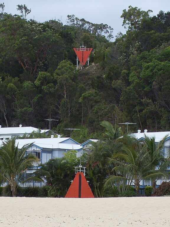
English: Navigational aids: Leading markers and lights indicating a preferred channel. These are at Tangalooma and indicate the channel to the wharf from the main ship navigation channel in Moreton Bay from the port of Brisbane. |
|---|---|
| Source |
I (- Peter Ellis - Talk) created this work entirely by myself. |
| Date |
2010-12-2 06:42 (UTC) |
| Author |
- Peter Ellis - Talk |
| Permission (Reusing this file) |
See below.
|
Licensing
Template:User at project, the copyright holder of this work, hereby publishes it under the following licenses:
You may select the license of your choice.
|


⧼wm-license-original-upload-log⧽
Template:Transferred from Template:Original description page
- 2010-12-02 06:42 Peter Ellis 1536×2048× (813684 bytes) {{Information |Description = [[Navigational aid]]s: Leading markers and lights indicating a preferred channel. These are at [[Tangalooma, Queensland]] and indicate the channel to the wharf from the main ship [[navigation channel]] in [[Moreton Bay]] f
File history
Click on a date/time to view the file as it appeared at that time.
| Date/Time | Thumbnail | Dimensions | User | Comment | |
|---|---|---|---|---|---|
| current | 09:59, 26 March 2024 | | 576 × 768 (136 KB) | Isidore (talk | contribs) | == {{int:filedesc}} == {{Information |Description={{en|Navigational aids: Leading markers and lights indicating a preferred channel. These are at Tangalooma and indicate the channel to the wharf from the main ship navigation channel in Moreton Bay from the port of Brisbane.}} |Source=I (- Peter Ellis - Talk)... |
You cannot overwrite this file.
File usage
The following page uses this file: