Size of this preview: 440 × 599 pixels. Other resolution: 1,292 × 1,760 pixels.
Original file (1,292 × 1,760 pixels, file size: 409 KB, MIME type: image/png)
Summary
Summary
| Description |
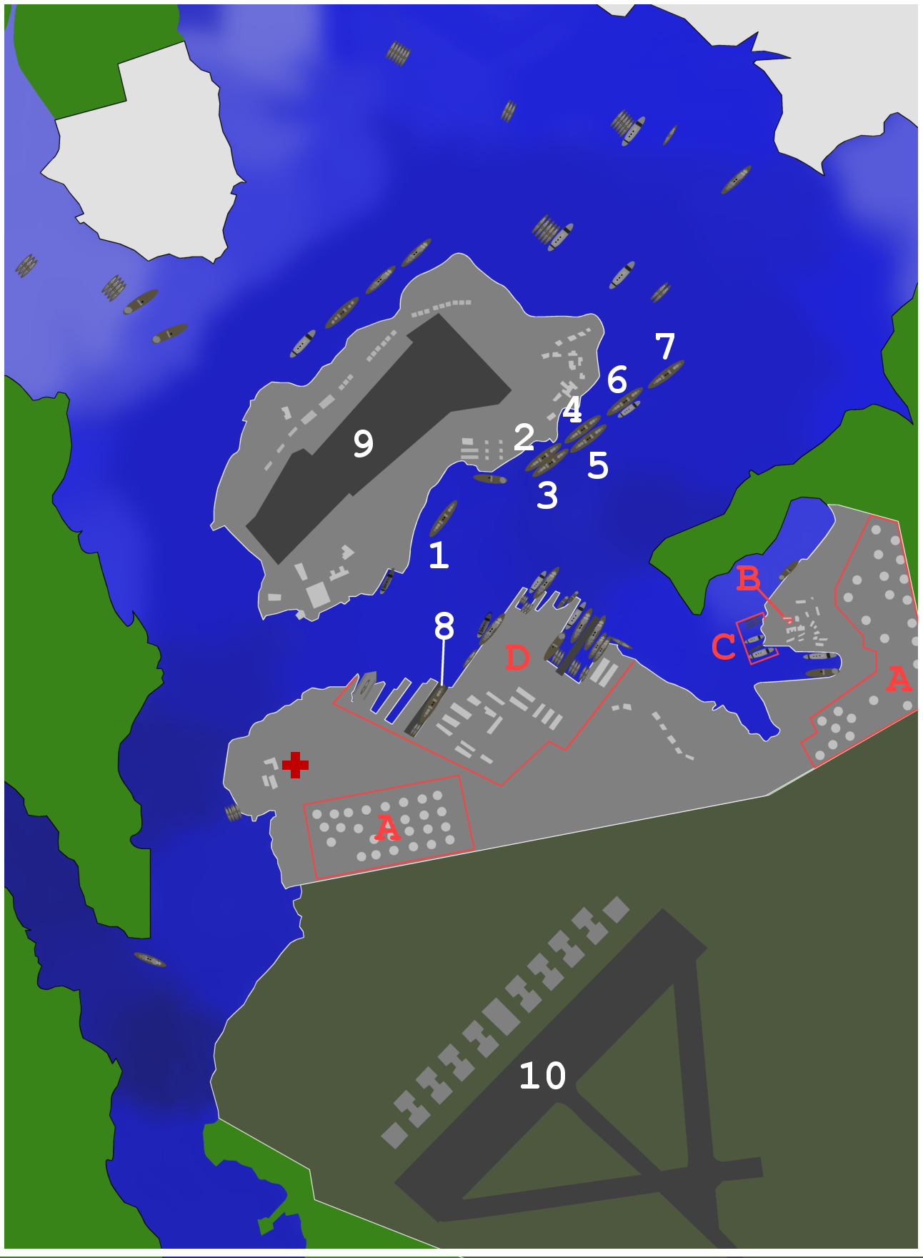
Map of ships and port facilities in Pearl Harbor during the attack. This text based legend is preferred: <21 ft
22-23 ft
29 ft
30-32 ft
33-34 ft
34-35 ft
36-37 ft
38-39 ft
40-41 ft
42-48 ft
>49 ft
City
Army base
Navy base
File:Phdepth.png |
|---|---|
| Source |
Template:Own using map from http://www.navsource.org/Naval/ as a reference. |
| Date |
2007-10-26 03:37 (UTC) |
| Author | |
| Permission (Reusing this file) |
See below.
|
Licensing
 | Permission is granted to copy, distribute and/or modify this document under the terms of the GNU Free Documentation License, Version 1.2 or any later version published by the Free Software Foundation; with no Invariant Sections, no Front-Cover Texts, and no Back-Cover Texts. |
| If this file is eligible for relicensing, it may also be used under the Creative Commons Attribution-ShareAlike 3.0 license. The relicensing status of this image has not yet been reviewed. You can help. |  |
File history
Click on a date/time to view the file as it appeared at that time.
| Date/Time | Thumbnail | Dimensions | User | Comment | |
|---|---|---|---|---|---|
| current | 22:20, 5 December 2023 | | 1,292 × 1,760 (409 KB) | Isidore (talk | contribs) | == {{int:filedesc}} == {{Information |Description=Map of ships and port facilities in Pearl Harbor during the attack. This text based legend is preferred: {{legend|#6C6FD9|<21 ft}} {{legend|#6467D8|22-23 ft}} {{legend|#5A5DD6|29 ft}} {{legend|#4F52D3|30-32 ft}} {{legend|#4346D1|33-34 ft}} {{legend|#3236CA|34-35 ft}} {{legend|#1F21C2|36-37 ft}} {{legend|#1F21AC|38-39 ft}} {{legend|#1F2195|40-41 ft}} {{legend|#1F2182|42-48 ft}} {{legend|#1E2076|>49 ft}} {{legend|#E1... |
You cannot overwrite this file.
File usage
The following page uses this file: