Original file (1,401 × 959 pixels, file size: 749 KB, MIME type: image/jpeg)
Summary
Summary
| Description |
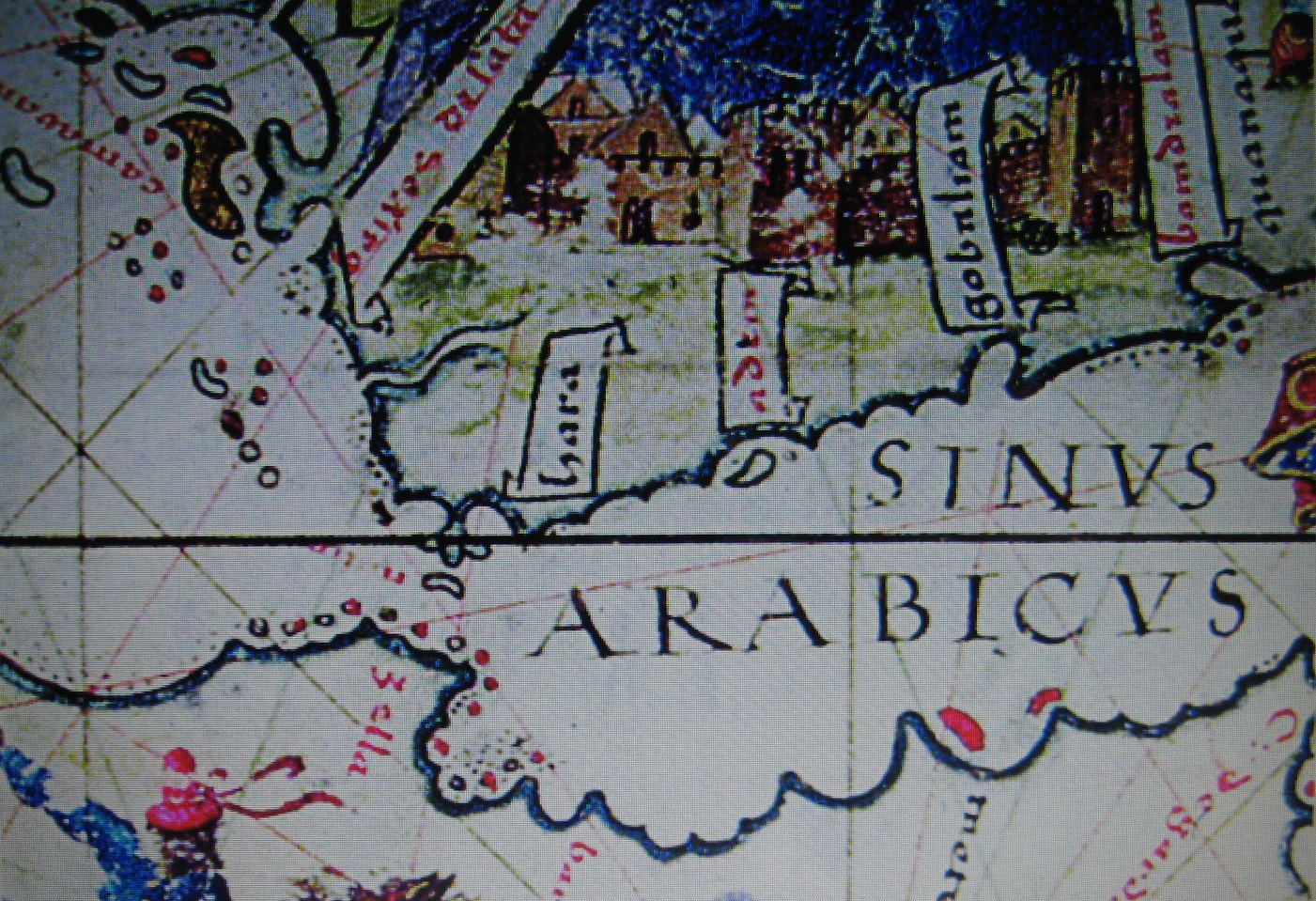
English: Enlarged view of a section of one of the panels of the 1519 Lopo Homem-Reineis Atlas (the Miller Atlas) showing the Gulf of Aden and the south of the Red Sea. The island of Perim ("Majun" on the map, from the Arabic Mayyun) is clearly shown at the junction of the Gulf and the Sea. To the north of Perim one can see the larger island of Kamaran ("Camaran"), that Albuquerque's fleet used as a base for some time after penetrating the Red Sea following its failure to capture Aden in 1513. Aden, a peninsula, is shown as an island, as on many later maps and engravings. |
|---|---|
| Source |
Many Internet sources including https://www.saudiaramcoworld.com/issue/200504/the.coming.of.the.portuguese.htm |
| Date |
2014-04-23 08:24:52 |
| Author |
The Miller Atlas (Lopo Homem-Reineis Atlas), 1519 (my cropping of a much larger map). |
| Permission (Reusing this file) |
See below.
|
Licensing
| This file is in the public domain, because (no reason given!)
Please verify that the reason given above is valid! Note: if there is a specific licence tag for the reason supplied here, please use it. |
File history
Click on a date/time to view the file as it appeared at that time.
| Date/Time | Thumbnail | Dimensions | User | Comment | |
|---|---|---|---|---|---|
| current | 15:43, 24 December 2023 | | 1,401 × 959 (749 KB) | Isidore (talk | contribs) | =={{int:filedesc}}== {{Information |description={{en|1=Enlarged view of a section of one of the panels of the 1519 Lopo Homem-Reineis Atlas (the Miller Atlas) showing the Gulf of Aden and the south of the Red Sea. The island of Perim ("Majun" on the map, from the Arabic Mayyun) is clearly shown at the junction of the Gulf and the Sea. To the north of Perim one can see the larger island of Kamaran ("Camaran"), that Albuquerque's fleet used as a base for some time after penetrating the Red Sea... |
You cannot overwrite this file.
File usage
The following page uses this file: