No higher resolution available.
Relief_map_of_USA_Alaska.png (776 × 580 pixels, file size: 693 KB, MIME type: image/png)
Summary
Summary
| Description |
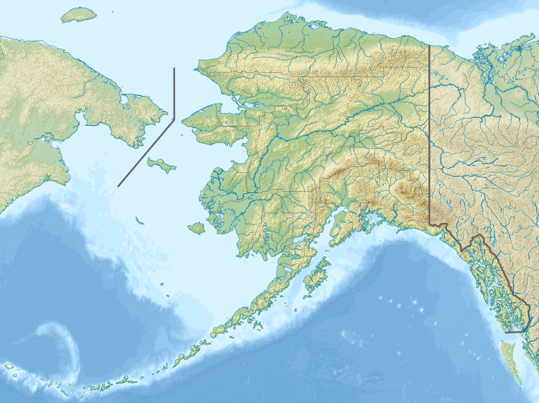
Template:Ru English: Relief map of Alaska, USA Equirectangular projection, N/S stretching 210.0 %. Geographic limits of the map:
| ||
|---|---|---|---|
| Source |
| ||
| Date |
2012-11-20 22:32:18 | ||
| Author | |||
| Permission (Reusing this file) |
See below. | ||
| Other versions |

Licensing
I, the copyright holder of this work, hereby publish it under the following license:
|
File history
Click on a date/time to view the file as it appeared at that time.
| Date/Time | Thumbnail | Dimensions | User | Comment | |
|---|---|---|---|---|---|
| current | 18:13, 9 February 2024 | | 776 × 580 (693 KB) | Isidore (talk | contribs) | =={{int:filedesc}}== {{Information |description= {{ru|1=Физическая карта Аляски.}} {{en|1=Relief map of Alaska, USA}} Equirectangular projection, N/S stretching 210.0 %. Geographic limits of the map: * N: 72.0° N * S: 51.0° N * W: 172.0° E * E: 129.0° W |date=2012-11-20 22:32:18 |source= * File:USA Alaska location map.svg for borders, rivers and coastline; by Alexrk2 * {{own}} using {{Created with GMT}} {{Inkscape}} |author=[[User:Nzeemin|Nzeem... |
You cannot overwrite this file.
File usage
The following 2 pages use this file: