Size of this preview: 614 × 599 pixels. Other resolution: 1,049 × 1,024 pixels.
Original file (1,049 × 1,024 pixels, file size: 457 KB, MIME type: image/png)
Summary
| Description | |
|---|---|
| Source | |
| Date |
2009-03-05 21:21 (UTC) |
| Author |
|
| Permission (Reusing this file) |
See below.
|
I, the copyright holder of this work, hereby publish it under the following license:
|
⧼wm-license-original-upload-log⧽
This image is a derivative work of the following images:
- File:Paddington_station_location_map.svg licensed with Cc-by-sa-2.0
- 2008-07-29T08:17:10Z Edward 548x535 (1779787 Bytes) == {{int:filedesc}} == {{Information |Description={{en|This map showing the location of [[w:London Paddington station|London Paddington station]]. It was created from [[w:OpenStreetMap|OpenStreetMap]] project data, collected by the comm
File history
Click on a date/time to view the file as it appeared at that time.
| Date/Time | Thumbnail | Dimensions | User | Comment | |
|---|---|---|---|---|---|
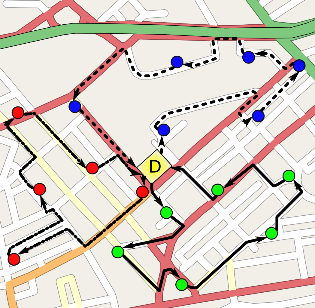
| current | 14:48, 29 January 2024 | | 1,049 × 1,024 (457 KB) | Isidore (talk | contribs) | {{Information |Description={{pl|Przykładowe rozwiązanie problemu marszrutyzacji. Utworzono trzy marszruty}} |Source=Paddington_station_location_map.svg |Date=2009-03-05 21:21 (UTC) |Author=*Paddington_station_location_map.svg: OpenStreetMap contributors (up by Edward) *derivative work: Maly LOLek (<span class="signature-talk">talk</span>) |Pe... |
You cannot overwrite this file.
File usage
The following page uses this file: